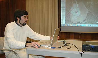
Stephen Schwartz showed digital satellite photographs of nuclear weapons facilities from around the world. Photo: Jennifer McNulty |
November 6, 2006
Cowell alum conducts 'sites unseen' tour of nuclear weapons facilities around the world
By Jennifer McNulty
Acknowledging at the outset that “most people don’t want to think about this,” nuclear policy expert Stephen Schwartz last week conducted a global virtual tour of nuclear weapons installations around the world.
With a laptop and the Google Earth program, Schwartz showed stunningly detailed digital satellite photographs of nuclear weapons facilities in the United States, Europe, and China, including the world’s largest munitions storage complex at Kirtland Air Force Base in New Mexico, where 1,900 nuclear weapons are held.
“Most people don’t realize these weapons exist,” said Schwartz (B.A., politics and sociology, ’87). “It’s not just North Korea and Iran we’ve got to worry about.”
Schwartz’s talk, dubbed “Sites Unseen: A Virtual Tour of Past and Present Nuclear Weapons Installations Worldwide,” was the first in a series of quarterly visits to UCSC by Cowell College alumni sponsored by the new Cowell Alumni Student Connection (CASC) program.
The virtual tour showcased the information available through aerial reconnaissance, a powerful tool used by war strategists since World War I, when hot-air balloons were used to gather information.
North Korea, which tested a nuclear device October 9, has been the focus of intensive aerial reconnaissance, said Schwartz, who zoomed in on images of the reactor building where plutonium for the device was produced.
“Analysts watch these sites, and if they see steam from the cooling tower, they know it’s operational,” said Schwartz, noting other telltale signs, including buildings “in the middle of nowhere,” roads that “disappear into mountainsides” where underground facilities are housed, and a missile launch pad and launch control site. “These sites have been very, very closely watched,” he said.
Combining the skills of a detective, a photo analyst, and a military security expert, Schwartz has identified sites and facilities around the world that previously only specialists at a few top government agencies knew about and could monitor.
Google Earth has “leveled the playing field” by making images accessible to anyone with a computer and high-speed Internet connection, maintained Schwartz, editor of The Nonproliferation Review published by the Monterey Institute of International Studies and coauthor of Atomic Audit: The Costs and Consequences of U.S. Nuclear Weapons Since 1940.
“The United States government has been a big purchaser of satellite images, but Google has bought them and made them available to the rest of us,” he said. “Previously, we had to take on faith whatever the government told us was going on at these sites, but now, thanks to Google Earth, we can go check up on them. We can look at our own forces and determine if our government is telling the truth.”
With nine acknowledged nuclear powers in the world—United States, Russia, Britain, France, China, Israel, India, Pakistan, and North Korea—the world needs many more watchdogs, said Schwartz, who considers Google Earth a powerful tool in the “democratization of intelligence gathering.”
“Technology like this puts potential proliferators on notice,” he said. “It tells them ‘We’re watching. We’re keeping an eye on you.’ ”
In addition to national security implications, the technology has infinite potential, from land-use planning to giving students the ability to “map every Wal-Mart in the country,” he said.
Responding to a question about domestic government surveillance, Schwartz conceded that “any technology could be used for ill” and acknowledged that terrorists could conceivably use the resource to advance their activities. But Google Earth images are generally two to five years old, the facilities themselves are very secure, and governments have been spying on each other for decades.
“These aren’t secret facilities,” Schwartz emphasized. “The Russians know where they are—and have known for decades. The Chinese, too. Anyone who would want to attack us knows about them.”
The government maintains what Schwartz called “shutter control,” which he demonstrated by zooming in on several locations, including Volkel Air Force Base in the Netherlands, to show how Google Earth has “fuzzed out” certain areas to obscure the images.
India and Pakistan have “complained” about what’s revealed on Google Earth, but Schwartz said he thinks ultimately “it’s almost impossible to keep people from getting access, which I think is probably healthy.”
Nevertheless, countries have adopted different strategies to try to protect their nuclear secrets. In 1998, during preparations to conduct nuclear tests, India attempted to literally work around satellite schedules, ceasing all above-ground work when analysts calculated satellites would be overhead, said Schwartz.
Similarly, Schwartz shared an archived satellite image of the construction of Iran’s Natanz nuclear facility that showed buildings, roads, tunnels, and other elements that analysts use to estimate the size and capacity of nuclear reactors. The Iranians subsequently covered the entire facility with earth. Zooming in on the current—and unremarkable--image that appears on Google Earth today, Schwartz simply noted, “They don’t want us spying on their activities.”
But Schwartz emphasized that the U.S. government uses far more sophisticated technology than what supports Google Earth, including satellites capable of making “real-time movies that show people moving back and forth.”
Schwartz’s tour included historically significant facilities such as the Oak Ridge, Tennessee, plant where the enriched uranium contained in the bomb dropped on Hiroshima was produced, and the Pantex Plant in Amarillo, Texas, where weapons are assembled—and 12,000 plutonium cores are stored.
The Nevada Test Site “looks like the moon,” said Schwartz, noting that all but 100 of the 928 tests conducted on the site were conducted underground. The site has been inactive since 1992, when President George H. W. Bush signed a moratorium on testing, but Schwartz zoomed in on the “Icecap Test Site,” which remains prepped and “available if needed.”
Finally, in a welcome bit of comic relief, Schwartz zoomed in on a building at Edwards Air Force Base that was built in the shape of the B-2 stealth bomber. “Of course, that’s only apparent from the air,” he noted wryly. “People know people are watching, and sometimes they have a little fun.”